Mill_s_Atlas_Atlas_of_the_State_of_South_Carolina_1825_01_xh

Mill’s Atlas Atlas of the State of South Carolina 1825

Mill's Atlas Atlas of the State of South Carolina 1825

Mill's Atlas Atlas of the State of South Carolina 1825
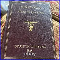
Explore the first atlas of an American state with Mill’s Atlas: Atlas of the State of South Carolina 1825. This historical hardcover book, published by Southern Historical Press in 1980, features 43 pages of detailed maps, including fold-outs, with a scale of 2 miles per inch. Authored by Robert Mills, this English language publication measures 8 1/2 inches in length, 11 inches in height, and 1 inch in width, weighing 3 lbs. I found one other that was in not as good shape with highlighting in it. It was listed for 899.00.
Mill's Atlas Atlas of the State of South Carolina 1825