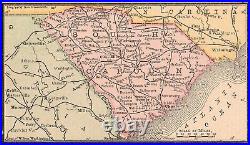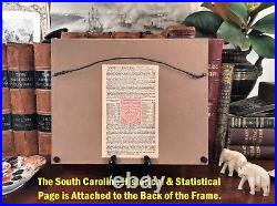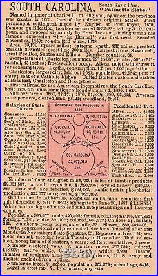


Fine Adornment of South Carolina History. Imaginative & Creative Gift. Framed 1886 Map of South Carolina. 1886 Historical & Statistical Information Attached to Back of Frame. Map is in Very Good/Good condition. No folds, writings, marks, or tears. Original Map Drawn & Engraved for the 1886 Edition of The History of the United States and Atlas of the World , Containing Color Maps of Each State and Territory of the United States, with Statistics showing Products and Resources, along with Maps of Every Country in the World; Published 1886 by W. Garfield: New York, 1886 ; a copy of the Title Page of which is Included. Framed with 1 3/8 Solid Wood Scrolled Molding, Archival Acid-Free Matting, Brown Paper Backing and Wire Hanger. Historical & Statistical Page Attached to the Back of Frame. Fine Map for the Collector. Makes a Creative & Imaginative Gift. Impressive On Any Home or Office Wall Map Dimensions: 2 7/8″x5 ” Outside Frame Dimensions: 8 1/4″x10 1/4″ Fine Adornment of South Carolina History. 1 3/8 Solid Wood Frame. Great for History & Genealogy, as Map shows Cities, Towns, & Landmarks of 1886, Some of which No Longer Exist Today. Historical & Statistical page on the Back of the Frame Includes: Named in honor of Charles II, of England, by whom the province was created in 1663. One of the original thirteen colonies. First permanent settlement made by the English at Port Royal in 1670. Seceded from the Union December 1860. Total land area: 30,170 square miles. Number of Counties: 84. Miles of railroad 1886: 1,698. Number of Farms (1880): 93,854. Number of flour and grist mills: 720. Number of Colleges: 3. Population (1880): 995,577. A Few of the Cities, Towns, Railroads, & Landmarks Shown on the Map: McCormick, Greenwood, Edgefield, Aiken, Greenville, Charleston, Strawberry, St. Stephen’s, John’s Island, Adams Run, Gourdin, Plantersville, Kingstree, Columbia, York, Cornwell, Chester, Smith’s Winnsboro, Alston, Shelton, Jonesville, Union, Marion, Mullin’s, Bucksville, Laurens, Willaimston, Spartanburg, Easley, Marietta, Cowpen’s, New Prospect, Santuck, Wellford, Helena, Cash’s Station, Chesterfield, Woodward, Hardeeville, Fort Beauregard, Ridgeland, Elko, Jackson, Robbins, Williston, Lancaster, Port Royal, Florence, Pendleton, Anderson, and many others. Greetings from Historical Savannah, Georgia: Founded 1733. Some, to beautify their halls, chambers, & studies… Loveth, getteth, and useth maps, charts. John Dee, Advisor to Queen Elizabeth I. This item is in the category “Antiques\Maps, Atlases & Globes\North America Maps”. The seller is “jonesjackson” and is located in this country: US. This item can be shipped to United States.
- US State: AL, FL, GA, MS, NC, SC, South Carolina
- Cartographer/Publisher: H.H. Hardesty
- Printing Technique: Lithography
- City: Columbia
- Date Range: 1800-1899
- Original/Reproduction: Antique Original
- Country/Region: United States of America
- Topic: Maps
- Publication Year: 1886
- Features: City, Town, Railroad
- Format: Wall Map
- Subject: History
- Type: State Map
- Year: 1886
- Frame: Solid Wood
- Detail: Cartography, Art

